MetMalaysia warns of heavy rain and strong winds
PETALING JAYA: Tropical storm Senyar is expected to hit 10 locations, with continuous heavy rain, strong winds and rough seas for the next two days.
In an emergency media conference yesterday, Malaysian Meteorological Department (MetMalaysia) director-general Dr Mohd Hisham Mohd Anip said this is the first time a tropical storm is reaching such strength.
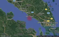
The storm is predicted to affect Kedah, Penang, Perak, Pahang, Selangor, Kuala Lumpur, Putrajaya, Negri Sembilan, Melaka and Johor.
Perak, Selangor and Pahang are expected to be the worst-hit by Senyar before it moves to the east coast.

“Based on projections from India’s Regional Specialised Meteorological Centre, the storm is expected to make landfall around the Perak-Selangor border, likely around midnight or after. The Klang Valley is an area of concern,” said Mohd Hisham.
“There will be continuous heavy rain for the next two days. The winds may reach up to 50kph.
“The storm may cause continuous heavy rain, strong winds and rough seas in most areas in the Strait of Malacca and many parts of Peninsular Malaysia once it enters our territory.
“We expect this situation to persist until Saturday.
“The public is warned to prepare for the rain, which will be more than 200mm. In the past few days, the rain we saw was only 120mm.
“Based on the latest information, the tropical storm is currently located at latitude 3.6° North and longitude 100.4° East, and it is expected to move eastward at a speed of 9kph.
“Malaysia is normally located outside the typical tropical cyclone pathway. However, we have previously experienced two direct tropical storm events which were Tropical Storm Greg on Dec 26, 1996, which hit Sabah and Typhoon Vamei on Dec 26, 2001, which affected southern Peninsular Malaysia.
“If we count today’s event, this is the third, and its uniqueness is that it is occurring in the Straits of Malacca – something that has never happened before. It has drawn not only local media attention but also international interest.
“MetMalaysia has issued weather advisories on this storm system since Nov 23 and updated every three hours. Current information is available on MetMalaysia’s website.
“Our monitoring area covers waters and land between the equator up to 20° North latitude, and from 95° East longitude (slightly west of Langkawi) up to 130° East longitude (east of Sabah).
“Any tropical storm developing within this zone will trigger advisories or warnings.”
He added that MetMalaysia will continue monitoring through radar, satellite and analysis from tropical storm monitoring centres in India and Japan.
“For updates, the public can visit our website, Facebook, X, Instagram [social pages] or download the free MyCuaca mobile app. Our hotline 1-300-22-1638 operates 24 hours.
“We strongly advise fishermen not to go out to sea in the Straits of Malacca and the South China Sea, and avoid sea-based activities.
“There is a strong typhoon currently in the region affecting the movement of Senyar.
“A stronger storm draws a weaker one, which is why this storm is crossing from west to east. Without that typhoon, this crossing might not occur.”
“Once the storm moves over land, it will weaken. It may intensify again when it reaches the South China Sea.
“It is expected to cross Selangor, Perak, Pahang and Terengganu, eventually joining the larger typhoon system in the South China Sea.”