About 100 Hong Kong wartime aerial photos being exhibited for the first time reveal valuable details about the World War II air raids in Kowloon, similar to the one associated with a bomb recently unearthed in Quarry Bay, a historian has said.
Professor Kwong Chi-man, chair of Baptist University’s history department, said the aerial photo collection of the Kowloon Peninsula, taken between 1941 and 1945, was retrieved from the United States National Archives and Records Administration.
Organised by the department’s Hong Kong Spatial History Project, the ongoing exhibition includes one rare image capturing the moment when Whampoa Dock in Hung Hom came under attack on April 5, 1945.
“It was recently found in an action report that clearly showed the bombing at that time, and the damage made in an earlier attack,” Kwong said, referring to the largest air raid in Hong Kong that took place on October 16, 1944, and killed about 900 civilians.
“During the Japanese occupation, Japan deemed Hong Kong a shipping and logistics base. Since October 1942, the Allied forces had launched attacks on dockyards to weaken their functions.
“There’s a chance we might find bombs in the waters off Hung Hom, alongside areas in Tai Koo, Admiralty and Wan Chai, that were under severe attack.”
A 1,000lb (454kg) wartime bomb unearthed in Quarry Bay last month was believed to have come from a US air raid targeting Taikoo Dockyard on April 2, 1945.
The exhibition also features other bombing attacks on the Kowloon Peninsula, including in Sham Shui Po and Yau Tsim Mong, a district comprising Yau Ma Tei, Tsim Sha Tsui and Mong Kok.
Taken by the Allied forces, the photos were part of their reconnaissance of the area before air raids on Japanese military facilities, and to confirm whether targets had been hit afterwards.
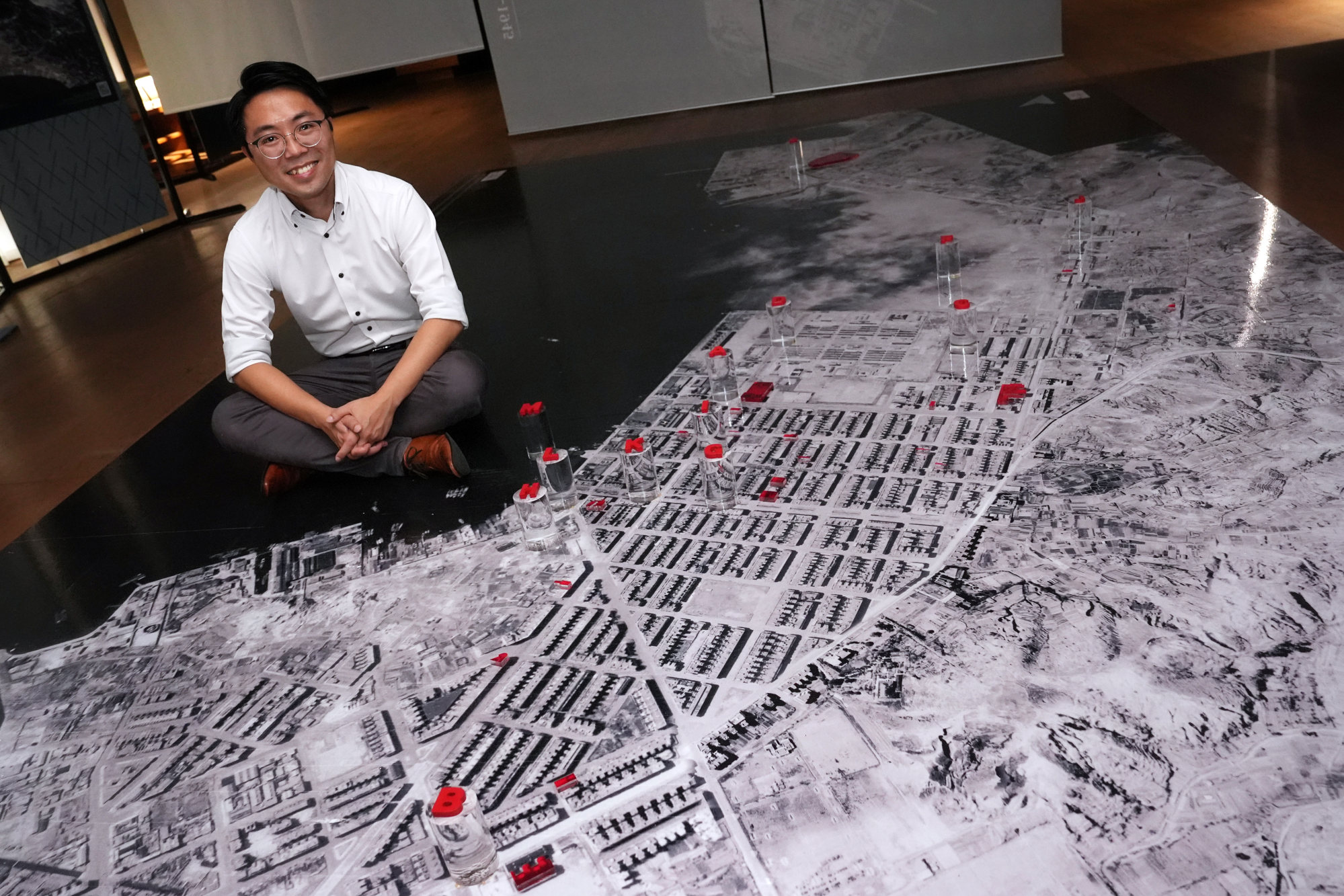
Kwong said the aerial images not only showed the bombing and the war’s impact on the urban space, but also offered resources for future study of wartime history, war remnants, regional development and historic buildings in Hong Kong.
He noted that the photo collection filled the gap in the city’s spatial historical data, as the government only filmed aerial shots in 1924, 1934 and 1945, after the war ended.
Along with related activities and an interactive map, the exhibition is part of a HK$1.9 million (US$244,200) project funded by the Built Heritage Conservation Fund, a government initiative that supports activities strengthening community awareness.
The free exhibition runs from September 25 to December 10 at Jao Tsung-I Academy in Sham Shui Po, CLP Pulse in Kowloon City and the ground floor of Kwong Wah Hospital in Yau Ma Tei. Each venue showcases aerial photos of the district in which it is located.
Kwong said his team had also collected wartime aerial photos of Hong Kong Island and hoped there would be opportunities to display them to the public in the future.
One image shows a massive hole at King George V Memorial Park, which corroborates oral testimonies of a mass grave in the area, according to Kwong. -- SOUTH CHINA MORNING POST
Already a subscriber? Log in
Get 20% OFF The Star Digital Access
Cancel anytime. Ad-free. Unlimited access with perks.