KATHMANDU; Nepal is set to conduct its first feasibility study for a proposed Himalayan tourism highway, with technical teams expected to begin fieldwork within days.
Nepal Infrastructure Construction Company Limited and the Department of Roads have signed an agreement to carry out the study. The agreement was signed shortly before Dashain, according to the company.
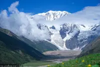
The first phase will cover two proposed road sections: a 105-kilometre route from Api Nampa in Darchula, through Saipal in Bajhang, to Badimalika in Bajura; and a 45-kilometre stretch from Num in Sankhuwasabha to Pathibhara in Taplejung.
The government aims to improve road safety in tourist destinations and attract more domestic and foreign visitors under the new initiative, said Shubharaj Neupane, deputy director-general and spokesperson for the Department of Roads.
“A feasibility study is being conducted for this purpose,” Neupane said. “Once the highway is built, it will help increase tourist arrivals and stimulate economic activity.”
The highest-altitude road built so far in Nepal is at Korala in Mustang, along the Kaligandaki Corridor, reaching an elevation of 4,600 metres, Neupane said.
The feasibility study will assess various options for the highway, including how existing connecting roads could be linked to the proposed routes. Roads connecting to the main highway through feeder routes could also be incorporated into the national highway network, he said.
“For now, we will study the routes connecting Darchula to Bajura and Sankhuwasabha to Pathibhara in Taplejung,” Neupane said, adding that the first phase focuses on destinations in Nepal’s far-western and far-eastern regions. “The highway will connect both tourist destinations and religious sites.”
The study is expected to take six months.
The government plans to complete the feasibility study in the current fiscal year and move towards construction the following year, Neupane said. A detailed project report will be prepared once the study is complete.
The choice between concrete and asphalt surfacing will depend on the findings, to build a highway that remains operational throughout the year, he added.
During the election campaign, Prime Minister Balendra Shah highlighted Nepal’s mountain destinations as alternatives to Switzerland, pointing to Badimalika, Ramaroshan and Khaptad National Park in the far-western region.
“Everyone talks about making Nepal the next Switzerland, but look at what we already have. Badimalika, Ramaroshan and Khaptad National Park are right here. We have so much to offer, yet we have failed to appreciate our own natural treasures or show them to the world,” Shah said in Dhangadhi during the election campaign.
Shah, who announced his candidacy from Jhapa-5, visited the Pathibhara Temple in Taplejung on January 22, 2026. The feasibility study is now being undertaken for proposed routes linking the western and eastern destinations.
Infrastructure Development Minister Sunil Lamsal said the government would move forward with the infrastructure needed to connect tourist destinations, including Badimalika and Pathibhara, through the proposed highway.
“We have introduced the Himalayan tourism highway as a new initiative and an important infrastructure project to connect our Himalayan regions with tourism,” Lamsal wrote on Facebook after the agreement for the feasibility study was signed.
Nepal Infrastructure Construction Company Limited plans to deploy two separate teams for the fieldwork before Tihar, said its chief executive officer, Prabhakar Thapa.
“The agreement for the feasibility study was signed shortly before Dashain, and we will submit the report within the stipulated six months,” Thapa said.
The study will cover technical, economic, social and environmental factors. It will also examine alternative road alignments and assess which routes would be most suitable, he said.
“We will study alternatives that would keep costs down, minimise environmental damage and benefit as many people as possible,” Thapa said. “The highway should also connect local markets and serve settlements conveniently.”
The final report will recommend the most suitable options for the proposed routes, he added.