KUALA LUMPUR: Two new hydrographic survey vessels planned under Budget 2027 are expected to strengthen Malaysia’s maritime security, defence preparedness and navigational safety by improving seabed mapping in the country’s waters.
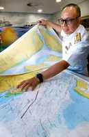
Navy Chief Admiral Tan Sri Zulhelmy Ithnain said the two new Survey Motor Launch (SML) vessels would expand hydrographic survey coverage, reduce gaps in seabed depth and topography data, and improve nautical charts.
"We currently have only one hydrographic survey vessel for seabed mapping, making it difficult to cover the country’s entire maritime domain.
"With the acquisition of two additional SML vessels, we hope to accelerate the mapping process and complete it by 2050," he told reporters after launching the Seabed 2030 Indo-Pacific Ocean Mapping Meeting and Data Sprint 2026 here on Tuesday (Oct 20).
He said the acquisition had been approved under the second rolling plan of the 13th Malaysia Plan (13MP), but the procurement process had yet to begin.
SML vessels are designed to survey shallow coastal waters that larger ships may struggle to access, collecting seabed data to produce nautical charts for safe navigation and maritime operations.
"The (new) vessels are expected to help reduce gaps in seabed depth and topography data, improve nautical charts and support defence readiness, maritime infrastructure development and marine resource management," Adm Zulhelmy said.
The event, which is on until Thursday (Oct 22) is hosted by the National Hydrographic Centre (PHN).
It brings together 250 participants from 33 countries, including hydrographers, government representatives, researchers and maritime industry professionals.
In his opening address, Adm Zulhelmy highlighted the importance of international cooperation in advancing ocean mapping.
"This is a wonderful reflection of what international collaboration can achieve, when an idea is supported by shared commitment, trust and a willingness to work together," he said.
He said the three-day meeting and data sprint would provide opportunities for participants to exchange expertise, explore new approaches to ocean mapping and strengthen professional partnerships.
"Over the next three days, this will be an excellent platform for sharing knowledge, exchanging experiences, and exploring new approaches to ocean mapping," he said.
PHN is Malaysia’s national lead hydrographic agency and has represented the country at the International Hydrographic Organisation (IHO) since 1975.
The meeting and data sprint support the Nippon Foundation-GEBCO Seabed 2030 Project, which aims to map the world’s ocean floor by 2030.
As of April, 28.7% of the global seabed had been mapped to modern standards, while the remaining 71.3% need more complete data.