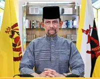
Brunei govt confirms that its country's map to be updated


Image from Borneo Bulletin/ANN

BANDAR SERI BEGAWAN, Feb 6 (Borneo Bulletin/ANN): Images and data produced from ‘Aerial Photography, Airborne LiDAR Acquisition and Geospatial Mapping of Brunei’s project will be used to update the map and geospatial information of the Sultanate for public and private agencies involved in national development planning as well as disaster management.

This aerial acquisition project is one of the approved projects under the 11th National Development Plan (RKN11). Contractor Syarikat Juruukur Fadly will execute the project, expected to be completed within 18 months.

Get 30% off with our ads free Premium Plan!

Monthly Plan

RM13.90/month
RM9.73 only

Billed as RM9.73 for the 1st month then RM13.90 thereafters.

Annual Plan

RM12.33/month
RM8.63/month

Billed as RM103.60 for the 1st year then RM148 thereafters.

1 month

Free Trial

For new subscribers only


Cancel anytime. No ads. Auto-renewal. Unlimited access to the web and app. Personalised features. Members rewards.
Follow us on our official WhatsApp channel for breaking news alerts and key updates!

Brunei , Country Man , To Be Updated


Next In Aseanplus News

Thai man serving record royal insult sentence faces new charges
Japan netizens discover stolen classic race motorbike after cosplayer posts it online
'Not for the poor': Indonesians in capital face housing, commute woes
Cambodian justice ministry: Reforms achieve record case resolution, boost public trust
Cycling to work in Malaysia is a challenge that is not for the fainthearted
South Korean Pension Service begins selling dollars to support won
As LA fights fires, Australian official urges more help from social media platforms
Malaysia’s 2025 growth steady at 5.0%, ringgit outlook positive
The onion fields of Indonesia's Panyaweuyan: More than just beautiful landscapes
To entrepreneur and actress Sarah Lian, CNY is a time for reflection and renewal

Others Also Read