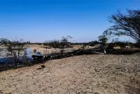
RAPID urbanisation and increasingly complex land development are placing growing pressure on local authorities to manage land records with greater accuracy and transparency. Yet, many still rely on outdated or fragmented mapping systems.
It is time they develop comprehensive, high-resolution digital maps of their jurisdictions. Modern geospatial technologies can make this effort both feasible and cost-effective.
High-resolution satellite imagery provides up-to-date land use records. Lidar (Light Detection and Ranging) enables precise elevation modelling for terrain, buildings, drainage and infrastructure.
Hyperspectral imaging adds environmental intelligence, detecting differences in vegetation health, soil composition, minerals and water quality beyond conventional imaging systems.
These capabilities are already available in Malaysia.
Lidar, for example, is widely used for infrastructure planning and flood management with extensive datasets maintained by the Department of Survey and Mapping Malaysia (Jupem).
Hyperspectral imaging is more specialised and project-based. Institutions such as Universiti Putra Malaysia (UPM) and Forest Research Institute Malaysia (FRIM) have applied it in forestry and agriculture while Tenaga Nasional Berhad (TNB) uses combined Lidar and hyperspectral drone data for vegetation monitoring near power lines.
The Malaysian Space Agency (MYSA) coordinates access to hyperspectral satellite data for government and research purposes. Integrating these datasets into municipal systems would significantly strengthen the integrity of land records.
Comprehensive digital mapping can also significantly reduce boundary and zoning disputes, strengthen long-term urban planning and support better decisions on transport networks, flood mitigation and environmental protection.
The technology is already available, and extending it to local governance through advanced geospatial infrastructure is both strategic and timely. The real question is whether local authorities are prepared to invest in the spatial intelligence needed for efficient governance.
DR ASRAF MOHAMED MOUBARK, DR FAZIDA HANIM HASHIM and DR AQILAH BASERI HUDDIN
Faculty of Engineering and Built Environment
University Kebangsaan Malaysia
Already a subscriber? Log in
Get 20% OFF The Star Digital Access
Cancel anytime. Ad-free. Unlimited access with perks.