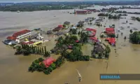
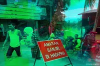
KUALA Lumpur City Hall (DBKL) is relying on its existing network of river sensors, sirens and closed-circuit TV (CCTV) cameras to monitor flood risks and warn residents during the north-east monsoon.
In a statement to StarMetro, DBKL said sensors at seven locations track river levels in real time and trigger sirens when water reaches a dangerous level.
It advised people living near these locations to stay vigilant; in the event a siren sounds, residents should take precautions and be ready to evacuate.
The seven locations are Taman U-Thant, Jalan Chan Sow Lin, Sungai Penchala, Jalan 9 in Kampung Cheras Baru, Jalan Rahmat, Jalan Batu Bata and Taman Tiong Nam.
DBKL maintains the seven sirens, while Kuala Lumpur Drainage and Irrigation Department (DID) operates its own sirens along the city’s main rivers.
When a siren sounds, officers at the Kuala Lumpur Command and Control Centre in Bukit Jalil will focus on live CCTV footage from that area, from its network of over 10,000 cameras across the city.
The footage helps DBKL identify flooded areas and warn residents to move their vehicles or avoid affected roads.
DBKL can deploy its Rescue Squad with a targeted response time of 15 minutes within a designated radius of its enforcement tower in Bandar Tun Razak, and 30 minutes outside that area.
The squad may be dispatched earlier if live footage shows that help is needed.
DBKL said it would immediately close flooded roads deemed unsafe by officers at the scene.
It is also working with National Disaster Management Agency and Malaysian Communications and Multimedia Commission to test a system that sends flood alerts to mobile phones.
The cell broadcast system is still being developed, with trials planned for selected flood-prone areas in Kuala Lumpur, Selangor, Kelantan and Pahang.
The alerts are expected to tell recipients the areas affected, what the conditions are like and the steps to take.
Meanwhile, DBKL has prepared 62 temporary evacuation centres that can accommodate up to 5,700 people.
An additional 182 schools under Kuala Lumpur Education Department can serve as evacuation centres, with space for up to 18,100 people.
The District Disaster Management Committee coordinates flood preparations and response. Its members include DBKL, DID, Malaysian Civil Defence Force, Fire and Rescue Department and the police.
A WhatsApp group is used to share updates and coordinate urgent action.
Kuala Lumpur mayor Datuk Seri Fadlun Mak Ujud previously said DBKL aimed to reduce the number of identified flood hotspots from 14 to 10 through measures including river dredging and on-site retention ponds.
The hotspots include Jalan Sultan Azlan Shah, Sultan Iskandar Highway, Bulatan Datuk Onn and Jalan Tun Sambanthan.