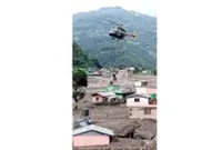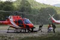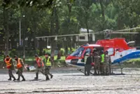
As rescue teams searched for missing people following catastrophic flooding along the Nepal-China border, scientists reviewed satellite imagery for clues to the cause and assessed the devastation.
Geomorphologists Kristen Cook and Dan Shugar said initial images from Nepal were obscured by clouds and dust from the debris, so they could only see that part of a glacier had broken off from Langtang Lirung peak, near the border with Tibet.
In clearer images from Thursday, they said they could see that the bedrock underneath the glacier had collapsed, taking the massive chunk of ice down with it and sending boulders and ice into the valley.
“It shows the whole area without anything hidden, and we could see that, yes, it looked like there was not only this glacier that had failed, but a much larger chunk of the bedrock of the mountainside itself that had given way,” said Shugar, associate professor at the University of Calgary.
“You have this big bedrock failure that took part of the glacier with it.”
After slamming to the valley floor, the debris maintained its momentum through the steep, narrow valley as ice melted, said Cook, at the Universite Grenoble Alpes in France. Water and mud several stories high swept through communities.
The Trishuli River surged during the flooding. Before and after satellite images of the Kolpurtar, Betrawati and Syapru Besi areas of Nepal show that the river is now much wider, and brown and black, because it overtopped its banks in some areas and filled with debris in others.
The change in the colour of the water shows how much sediment the flow was carrying, turning from greenish to very brown because it’s full of mud, Cook said.
Towns and villages that were devastated along the river banks are submerged in debris and mud. They appear as areas of brown. Some houses are still poking through in an image of the Betrawati area.
The flooding toppled and swept away buildings in Syapru Besi, a popular tourist spot where a famous trek to Langtang begins. In before and after images, a side river is now wider too, because the flow was so powerful it pushed upstream.
“While we cannot at this point directly link this collapse to climate change, it is not unexpected to see more events of this type with a warming climate,” Cook said. “Not this big, hopefully not this big.” — AP