
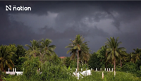
BANGKOK: Persistent rain caused flooding on Koh Samui in Surat Thani on Thursday (Nov 12), prompting police to urge residents and tourists to postpone non-essential journeys.
Koh Samui Police Station reported water covering the road outside Koh Samui City Municipality’s offices at 8.28am.
Small cars could still pass, but motorists were advised to take extra care to avoid accidents and prevent their engines from stalling.
Although rain eased somewhat by late morning, police maintained their travel advice and urged people to follow local alerts.
The municipality activated an emergency plan and closed the sluice gate on Chaweng Canal to prevent seawater from flowing back into the canal and low-lying areas.
The measure aimed to stop flooding from spreading into areas of economic activity and key communities.
Large pumps were operating at full capacity to discharge accumulated water into the sea.
The water situation required round-the-clock monitoring, and officials were tracking water levels and rainfall in real time so they could adjust their response immediately if rain returned.
The Thai Meteorological Department’s Southern-East Coast Meteorological Center issued a warning for heavy rain and rough seas on November 12–13.
The warning was signed by Weera Samalee, director of the Upper Northeastern Meteorological Center and acting director of the Southern-East Coast Meteorological Centre.
Isolated heavy to very heavy rain was forecast for Chumphon, Surat Thani and Nakhon Si Thammarat.
Isolated heavy rain was expected in Prachuap Khiri Khan, Phatthalung, Songkhla, Pattani, Yala and Narathiwat.
People were advised to remain alert to thundershowers, gusty winds and accumulated rainfall that could trigger flash floods and rapid run-off, particularly on foothill slopes near waterways and in low-lying areas.
Winds and waves were expected to strengthen in the Gulf of Thailand, with waves reaching two to three metres from Nakhon Si Thammarat southwards and exceeding three metres in thundershowers.
Mariners were advised to navigate cautiously and avoid thundershowers, while small boats in the lower Gulf should remain ashore throughout the warning period.
The conditions were attributed to a fairly strong high-pressure system, or cold air mass, from China extending over upper Thailand and the South China Sea, combined with a moderate north-east monsoon over the Gulf of Thailand, southern Thailand and the Andaman Sea. - The Nation/ANN