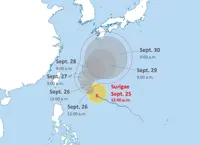
TOKYO: Typhoon Chan-hom, also known as Typhoon No. 15, is expected to draw very near Japan’s Kanto region – which contains the Tokyo metropolitan area – in the afternoon of Aug 11, before making landfall.
The typhoon was located about 260km east of Iwaki, Fukushima prefecture, at 9am (8am, Singapore time), moving west-north-west at approximately 30kmh, according to the Japan Meteorological Agency (JMA).
The central atmospheric pressure was 985 hectopascals, with maximum sustained winds of 83kmh and gusts of up to 126kmh.
Warm, moist air is expected to flow in over eastern Japan. Combined with the influence of high-altitude cold air, atmospheric conditions are expected to become extremely unstable.
On Aug 11, heavy to extremely heavy rain is expected across a wide area of eastern Japan, with localised heavy downpours.
Strong to very strong winds are expected in eastern Japan, and the Pacific coast may experience rough seas accompanied by swells. The typhoon is expected to weaken into a tropical depression on Aug 12 after passing over Honshu and travelling along the Sea of Japan coast.
The JMA urged residents in the Tohoku region to remain on high alert for landslides through Aug 12. The agency also warns of flooding in low-lying areas, as well as river levels rising and even overflowing.
It advised residents in the Tohoku region to remain vigilant through Aug 12, adding that those in the Kanto-Koshin region should be on alert on Aug 11.
The typhoon’s direct approach of Japan from the east is highly unusual. If it makes landfall in Fukushima or Ibaraki prefectures, it would be the first time since records began in 1951. - The Japan News/ANN