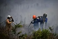

LUMAJANG (East Java): Mount Semeru, located on the border of Lumajang and Malang in East Java, Indonesia, erupted Thursday morning (Jan 8), sending volcanic material approximately 700 metres above the summit, Antara News Agency reported, quoting officials.
"The eruption occurred on Thursday (January 8) at 07.14 am local time, with the ash column reaching roughly 700 metres above the 4,376-metre summit,” said Semeru observation post officer Sigit Rian Alfian.
He added that the ash plume appeared white to grey and was thickest towards the northwest. The eruption was recorded on seismographs with a maximum amplitude of 14 millimetres and lasted about 120 seconds.
Semeru recorded four eruptions on Thursday, starting at 00.33 am local time.
The first ash column reached 700 metres, followed by 600 metres at 05.19 am.
Subsequent eruptions occurred at 5.25 am and 7.14 am, both reaching approximately 700 metres above the summit.
The volcano remains at Level III (Alert). The Centre for Volcanology and Geological Disaster Mitigation (PVMBG) has issued safety recommendations for residents.
People are prohibited from entering the south-east sector along Besuk Kobokan within 13 kilometres of the summit.
Outside that zone, residents must stay at least 500 metres from riverbanks along Besuk Kobokan due to the potential for pyroclastic flows and lahars, which can extend up to 17 km from the summit.
Activity is also banned within a five-km radius of the crater due to the risk of volcanic rock ejections.
Authorities warned residents to remain alert for pyroclastic flows, lava collapses and lahars along rivers originating from the summit, including Besuk Kobokan, Besuk Bang, Besuk Kembar, Besuk Sat and smaller tributaries.
Mount Semeru has a history of repeated eruptions. On Thursday night, January 1, 2026, an eruption at 18.37 local time sent an ash column approximately 900 metres above the summit, or 4,576 metres above sea level.
The ash appeared white to grey, thickest towards the north-east and east, and registered 23 mm on seismographs, lasting 153 seconds. Data show that Semeru erupted four times at the start of 2026, including an eruption at 01.26 am, when the ash column reached roughly 1,000 metres above the summit. - Bernama/Antara